Like the rest of Boston, Boston Harbor is underlain by rock known as Cambridge Argillite (also known as "Cambridge Slate" - it's the same rock). This rock is a dark, layered, slightly metamorphosed mudstone. In some areas microfossils can be found (no macrofossils have been found in this rock). In some parts of the islands, outcroppings of Roxbury Conglomerate and Quincy Granite can be found, although the predominant bedrock is the Cambridge Argillite.
In most cases, the bedrock is many tens of feet below the land surface. Instead, what you find is layers of clay, sand and gravel. The top layers tend to have larger gravel and sand, and as you go deeper, the clay becomes more predominant. Over thousands of years, continental ice sheets repeatedly advanced and retreated across New England, leaving in their wake these thick layers of sediment.
As you can see in Figure 1, the Wisconsin Ice Sheet covered the bedrock with thousands of feet of glacial ice. This ice was not stationary - it slowly moved. As it moved over land, it would scour the surface, breaking up rock. Pieces of rock and other material would then get incorporated into the ice. These pieces would move the glacier - in many cases they could get moved hundreds of miles from their place of origin. Then, as the climate warmed and the ice sheet retreated, this material would be deposited on the surface. For a description of glacial features, please see the page "Glaciers and Boston".
Drumlins are prominent glacial feature in Massachusetts. These are hills consisting of glacial debris - there are more than 200 drumlins found in the Boston Area, and the inner Harbor Islands are made up exclusively of drumlins (some are connected, and some have been eroded, but they are all drumlins).

Map of Boston Inner Harbor, showing many of the islands and the Nantasket penninsula. Click on the image to see the drumlins.
Formation of Boston Harbor Islands
The Boston Harbor Islands formed as a result of glacial deposition and changing sea levels. The story begins with the Ice Age (see the page "Glaciers and Boston"), when this area was covered with thousands of feet of ice.

This shows the Boston Harbor as it probably appeared during the Ice Age. 1500 to 2000 feet of glacial ice covered the bedrock. (Photographed from a display on Bumpkin Island.)
As the ice sheets retreated, they left behind many hills of debris called drumlins. The sheer weight of so much ice had literally caused the land to sink. Even though the melting ice caused the amount of water in the ocean to increase, the land itself rose due to the release of this weight. For a few thousand years, the sea level was much lower than it is today. The Boston Harbor Islands were not actually islands!

After the ice sheets retreated, they left behind hills of glacial debris known as drumlins. After an initial rise in sea level (due to melting ice), the land literally rebounded from the release of the mass of ice, and sea level fell to a level much lower than today. So the harbor islands as they appear today would have been a set of hills on a grassy plain. (Photographed from a display on Bumpkin Island.)

Over the past few thousand years, the land stopped rebounding, and the sea level continued to rise, submerging the plain and leaving the drumlins visible as islands. (Photographed from a display on Bumpkin Island.)

Looking North at Peddocks Island, which consists of several drumlins connected. The connecting land between drumlins is known as a tombolo. You can see four of those drumlins against the Boston skyline. Gallups Island is the drumlin on the far right, behind Peddocks.

A partially eroded drumlin at the tip of Peddocks Island.

A view of the single drumlin that makes up Georges Island.

An eroded bluff on Lovells Island. Here you can see the mixture of sand, clay, and gravel that make up the glacial deposits. You can also see how sharply the edge of the drumlin drops off.

This picture shows a closeup of the same bluff. Note that the layers at the top, about a foot deep, represent the soil that has formed after the drumlin was formed.

This rock, known as "Lover's Rock", is a glacial erratic, a large boulder that was moved from far away by the advancing glaciers, and then deposited on top of the drumlin as the glacier retreated. This rock is granite, which was initially formed at least 10-20 miles away, and perhaps even farther. (For another dramatic example of a glacial erratic, check out "Big House Rock" in Weymouth.)
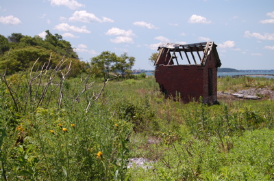
What Have The Islands Been Used For?
There is evidence that Native Americans inhabited the Boston Harbor Islands area as early as 5,000 years ago. At that time, the islands were not islands. Recall from above that because of lower sea levels, the harbor islands were a set of hills (drumlins) in the midst of a grassy plain. The early native people who inhabited this area used the hills (and the grassy plains between them) as well as the coast (now under water much farther East than today).
For more information about the Native Americans on the Harbor Islands:
Overview of archaeological discoveries from the Institute of Maritime History (specifically from Rainsford Island, but applicable to all the islands)
Questions to Explore:
Europeans began settling permanently in the Boston area in the early 1600's. Soon after, the islands became used for a variety of purposes. These purposes have changed over time.
Some of these purposes included:
- Farming
- Homes
- Defense of shipping channels within Boston Harbor and the city itself
- Fishing
- Hospitals and Orphanages
- Homeless Shelter
- Prisons
- Garbage Dumps
- Sewerage Disposal
- Summer Camp
- Vacation/Recreation Area
For each of these, consider why the islands were chosen as a location for this purpose, given how difficult it is to get there.
More to Explore:
Below are many pictures showing a wide variety of uses for the Boston Harbor Islands area. Look at each picture carefully (you can click on each one to enlarge) and briefly describe the uses you see in the photo.